1st Stage
The 1st stage starts in Vila do Porto, ends in the rural area of Cardal and has a length of 17.1 kilometers. Along this route, you can visit, among others:
-
São Brás Fort:
-
17th century military construction, whose main function was to protect the island from corsair attacks and looting. Currently it is a reference point to visit in Vila do Porto.
-
-
Pedreira Field (Campo da Pedreira):
-
This old exploration source stands out today for its great abundance of fossil content. Being the oldest island in the archipelago, Santa Maria is the only one to have this type of vestiges.
-
-
Figueiral Cave:
-
In this artificial cave it is also possible to find fossil records. Originally exploited for its clay, the Gruta do Figueiral has not only marine fossils, but also stalactites.
-
-
Formosa Beach:
-
It stands out for its light-colored sand, something uncommon in the other islands of the archipelago, and for the vegetation-covered slopes that surround the beach.
-
-
São Lourenço Bay:
-
Formed in a volcanic crater, this bay has small beaches scattered along its length, a natural pool and the famous vineyards allocated on its slopes. A little south of São Lourenço beach, you can find the São Lourenço Islet.
-
-
Maloás Stream:
-
Also known as “Calçada dos Gigantes” (“Giants Boardwalk”), it is located in the place of Malbusca. It presents a waterfall with a height of about 20 meters and its formation resulted from the contact of the sea with the lava flows.
-
Photo of Pedreira Field taken by SIARAM ©
2nd Stage
The 2nd stage starts in Cardal, ends in Lugar do Norte and has a length of 21.5 kilometers. Along the route, you can find, among others:
-
Ponta do Castelo:
-
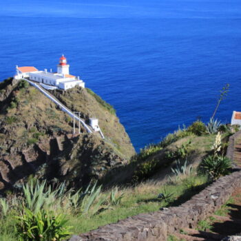
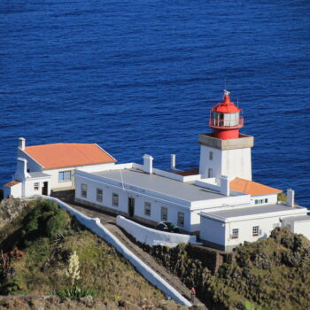
Located on the southeast coast of the island, the famous Gonçalo Velho Lighthouse is located here. Besides being able to easily spot different bird species, including the Cagarro, you can also go down to the old Whaling Factory and get to know an important part of the History and culture of the island.
-
-
Gonçalo Velho Lighthouse:
-
Located at Ponta do Castelo, the lighthouse is open for visits (by reservation), giving you the opportunity to learn more about its history and operation. From here you can get a fantastic view of the Bay of Maia.
-
-
Aveiro Waterfall:
-
Located in the Maia area on the eastern coast of Santa Maria Island, this imposing waterfall is over 100 meters high. It is formed by two basins of water that crash vertically down the eroded cliff.
-
-
Espigão Viewpoint:
-
Also known as Miradouro de São Lourenço, this viewpoint provides, as the name implies, a fantastic view over São Lourenço Bay and its steep green slopes.
-
-
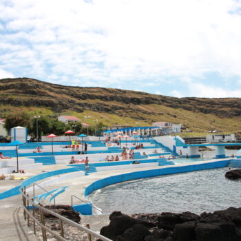
View to the islet of Lagoínhas.
3rd Stage
The 3rd stage starts in the center of Lugar do Norte, ends in Lugar das Bananeiras and is 16.5 kilometers long, being this the shortest stage of the Great Track. Along the route, you can find, among others:
-
Passing through the localities of:
-
Lagos;
-
Poço Grande;
-
Boavista.
-
-
Poço da Pedreira:
-
A lake originated by rain in a quarry, thus creating a beautiful place where the activity of Man and Nature come together to produce a stunning landscape.
-
-
Ribeira do Salto/Cascata de Cai’Água:
-
Included in the Pico Alto Volcanic Complex, this waterfall stands out as it results from a junction of Ribeira do Forno and Ribeira da Malhadinha, forming a double waterfall.
-
-
Pico Alto:
-
With an altitude of about 590 meters, it is the highest point on the island. From its belvedere you can admire a magnificent panoramic view of the entire island. It is also possible, depending on the weather conditions, to see the neighboring island of Santa Maria, São Miguel.
-
4th Stage
The 4th stage starts at Lugar das Bananeiras, ends in Vila do Porto and is 23.5 kilometers long, being this the longest stage of the Great Track. Along the route, you can find, among others:
-
Raposo Bay:
-
This beautiful waterfall belongs to the Natural Park of Santa Maria Island and is considered an Area of Protected Landscape of Barreiro da Faneca and North Coast. This place is also visited by the North Coast Trail.
-
-
Barreiro da Faneca:
-
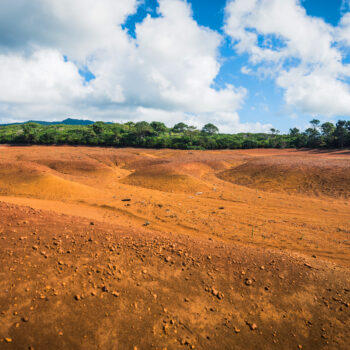
It is a vast area of arid and clayey terrain, constituting a reddish-yellow desert landscape of unique feature in the Azores.
-
-
Anjos:
-
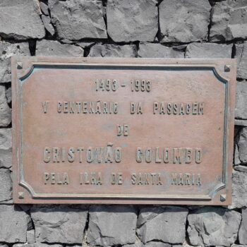
Small parish with great historical significance, as it is believed to have been the place where Christopher Columbus landed on his return from his voyage of discovery of America. Also because it is located very close to the sea, it has some natural pools suitable for diving.
-
-
View to Vila do Porto Islet:
-
Classified as a Natural Reserve area, the Vila do Porto Islet is home to a wide variety of seabird species, such as the Cagarro, the Frulho, Painho-da-Madeira, among others.
-


